

Clark students participate in the CTE Mission: CubeSat competition
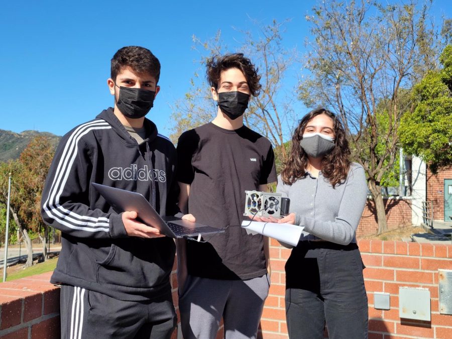
Juniors Matthew Keshishian, Daniel Bet Sarghez, and Gabriela Marcucci with the CubeSat they have designed.
Clark’s GIS and Remote Sensing team decided to take on the challenge of making a CubeSat, which is a device similar to a satellite that is meant to be sent to space. However, the team had no intentions to send it to space. Instead, the team attached the CubeSat to a weather balloon and flew it over the Hansen Dam Recreational area. They flew it twice; once on April 28 and once on May 7.
Knowing that California is a high-risk fire state for wildfires and that many people are homeless with no shelter, the team wanted to find out if a certain zone was occupied by the homeless. Before making the CubeSat, the team did a practice flight over Ventura Willoughby Preserve with a drone that had an infrared camera attached to it. This confirmed that their infrared camera is able to capture thermal images which helped them spot the homeless.
After the practice flight, they started to build their CubeSat. Everyone had a role in building each of the parts while the frame was built by their project partner. Junior Daniel Bet Sarghez said that designing the CubeSat was easy but the code they used gave them many difficulties. “We initially wanted to use a program called XinaBox that had preloaded code on it, but the code wasn’t working so we opted to move all the code and firmware onto our arduino,” Bet Sarghez said. He also explained that they had “trouble with the infrared camera as it was not compatible with the arduino.” They went through four cameras before they found the one that worked best.
Now that the CubeSat was finally built, it was ready to take off. The first time the CubeSat took flight was on April 28. Instead of using the drone they used for the practice flight, they attached the CubeSat to a weather balloon. The GPS was not working properly, so they used an app called Strava to map the path of the balloon. However, the operation was cut short due to heavy winds.
The second time they flew the CubeSat was on May 7. The only thing they did differently was that they attached a phone recording the coordinates onto Strava to the CubeSat. It provided more accurate data of the flight path. However, the flight was cut off yet again due to a wildfire that had surprisingly started.
Even with all the troubles the team ran into, it was definitely worth it in the end, team members said. The team was awarded one of five finalist positions nationwide and was challenged to implement their mission. “Being awarded a finalist position in the competition felt amazing and we were all ecstatic when we heard the news,” Bet Sarghez said. “Getting the recognition from the competition gave us confidence in our work and also pushed us to produce better work and more accurate data.”
“The experience of building the CubeSat was great! We all learned a lot about the scientific method, how to write a research paper and software such as ArcGis,” Bet Sarghez said.

Hobbies/interests: Listening to music and watching Netflix
Fav artist: BTS
Movie you never get tired of watching: Five Feet Apart
Goal for the...